|
|
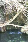
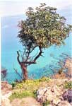
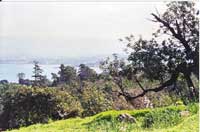
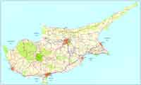
Akamas , Photo : Augusta Stylianou Artist Akamas (Greek: Ακάμας), is a promontory and cape at the northwest extremity of Cyprus, which Ptolemy described as a thickly wooded headland, divided into two summits rising towards the north. (Ptol. v. 14 § 1; see also Plin. Book 5 § 35[1]). Up until the year 2000, the peninsula was used by the British Army and Navy for military exercises and as a firing range. Under the 1960 Treaty of Establishment, the British army was allowed to use the Akamas for exercises for up to 70 days a year. [2] At the southern end of the peninsula is the town of Pegeia and on its northeast side the town of Polis. See also On the Fauna and Flora of Akamas References 1. ^ Pliny the Elder, The Natural History,English translation, Book 5 § 35 [1]. Images Cyprus, Paphos District
 |
|
||||||||||||||


|
|