|
|
and the temple of Zeus Ithomatas on the summit of the acropolis with a statue by the famous Argive sculptor |
||
| Population: (2001) |
11041 | ||
| Elevation: -lowest: -centre: -highest: |
Messenian Gulf 5 m(centre) around 200 m |
||
| Postal code: | 242 00 | ||
| Area/distance code: | 11-30-27220 (030-27510)-2 to 4 | ||
| Municipal code: | 3822 | ||
| Car designation: | KM |
||
| 3-letter abbreviation: | KAB | ||
| Name of inhabitants: | Messenian
or Messinian sing., -s pl. |
||
| Address of administration: | 13 D. Karatza St. Messini 242 00 |
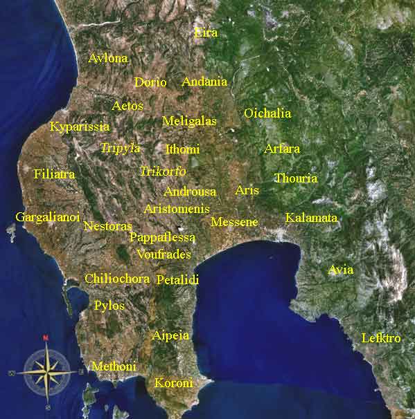
Messene remained a place of some importance under the Romans, but we hear nothing of it in medieval times and then the hamlet of Mavromati occupies a small part of the site. The city has been revived, and is home to 6693 people (2001). The present location of Messini is about 2 to 2.5 km S of the archaeological site. Messene is a suburb of Kalamata nowadays. It is no longer the capital of Messenia.
Messini has schools, lyceums, gymnasia, banks, a post office, and squares (plateia) named Kentriki Plateia or Central Square. The square is surrounded with a few pine trees with a building to the southwest, grass with two walkways to the north along with a few palm trees; a famous white clock tower without windows is in the middle of the square.
The town is accessed by Greece Interstate 82 (Pylos - Kalamata - Sparta) which has been bypassed in the south and a road to Efa (Eua) to the north. The nearest beach is in the southwest. The farmlands which used to resemble a wetland are to the southeast.
Messini used to have a railway station from the 1900s with a connection of the SPAP line about 5 km east and the westernmost terminus of this line, until the abandonment in the late 20th century.
Landmarks near Messene today include the airport of Kalamata at its east, and beaches south of the city.
Nearest places
- Velika Beach, SW
- Velika, W
- Mavrommati, NW
Division of the municipality
- Messini / Δ.δ. Μεσσήνης [ 6.912 ]
- Messini / η Μεσσήνη [ 6.693 ]
- Agios Konstantinos / ο Άγιος Κωνσταντίνος [ 85 ]
- Mylonas / ο Μυλωνάς [ 29 ]
- Xinos / ο Ξινός [ 105 ]
- Messini / η Μεσσήνη [ 6.693 ]
- Avramion / Δ.δ. Αβραμιού [ 591 ]
- Avramion / το Αβραμιόν [ 413 ]
- Agios Avgoustinos / ο Άγιος Αυγουστίνος [ 14 ]
- Drakonerion / το Δρακονέριον [ 164 ]
- Avramion / το Αβραμιόν [ 413 ]
- Analipsis / Δ.δ. Αναλήψεως -- η Ανάληψις [ 354 ]
- Velika / Δ.δ. Βελίκας [ 407 ]
- Velika / η Βελίκα [ 310 ]
- Paralia Velikas / η Παραλία Βελίκας [ 97 ]
- Velika / η Βελίκα [ 310 ]
- Kartolerion / Δ.δ. Καρτερολίου [ 599 ]
- Kartolerion / το Καρτερόλιον [ 529 ]
- Moschochorion / το Μοσχοχώριον [ 70 ]
- Kartolerion / το Καρτερόλιον [ 529 ]
- Lefkochora / Δ.δ. Λευκοχώρας -- η Λευκοχώρα [ 358 ]
- Lykotrafos / Δ.δ. Λυκοτράφου [ 347 ]
- Lykotrafos / ο Λυκότραφος [ 259 ]
- Myrtopotamia / η Μυρτοποταμιά [ 88 ]
- Lykotrafos / ο Λυκότραφος [ 259 ]
- Madena / Δ.δ. Μαδένης -- η Μάδενα [ 143 ]
- Mavrommation / Δ.δ. Μαυρομματίου Παμίσου -- το Μαυρομμάτιον [ 388 ]
- Neochorion / Δ.δ. Νεοχωρίου Αριστομένους -- το Νεοχώριον [ 250 ]
- Pilalistra / Δ.δ. Πιλαλίστρας -- η Πιλαλίστρα [ 196 ]
- Piperitsa / Δ.δ. Πιπερίτσης -- η Πιπερίτσα [ 143 ]
- Spitalion / Δ.δ. Σπιταλίου -- το Σπιτάλιον [ 141 ]
- Triodos / Δ.δ. Τριόδου -- η Τρίοδος [ 212 ]
Historical population
| Year | Communal population | Municipal population |
|---|---|---|
| 1981 | 6854 | - |
| 1991 | 6453 | 10493 |
| 2001 | 6693 | 11041 |
Google Earth
|
Municipalities and communities of the Messinia Prefecture
. Swansea: The Classical Press of Wales, 2004. Pp. xxiv, 244. ISBN 0-9543845-4-7.
 |
|
||||||||||||

|
|