|
|
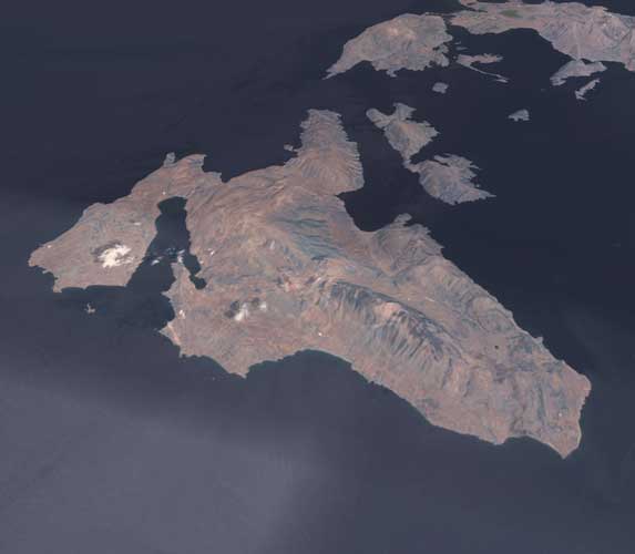
Kefalonia (or Cephalonia) island (close is the smaller Ithaca island), [Source]
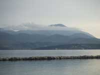
Mount Aenos or Ainos (Όρος Αίνος Ancient and Modern Greek) is the tallest mountain in Cephalonia, the elevation at the top of the point stands at 1628 m (around 5,350 ft.) Almost tying up Mile-High city of Denver, Colorado which is located on a high plain in North America. Its location is 38.116/38°07'00" N and 20.666/20°40'00" E.
Pine forests are found between the elevation of 700 to 1200 m. At the elevation from sea level up to about 300 m, there are beaches, farmland, communities ranging from Argostoli to Poros are placed. A main road connects Argostoli and Poros (40 km long) is commuted. elevation of 300 to 500 m, olive and laurel trees are founded. Above 1200 m, mountain slopes is mainly barren, rocky and harsh. The mountain range covers almost 3/4 of the island from Poros to Assos. A view of the Peloponnese (from Patras to Pyrgos, Psathopyrgos NE of Patras down to the Krestena area and tiny bits of Erymanthus valleys during clear and hazy-less days). and Aetolia along with the islands of Zante, Lefkada, and Ithaca is spectacularly seen. Nightlights of almost all of Cephalonia's villages and Argostoli, Kyllini coast, Chlemoutsi, most of Zante, most of Lefkada, entire Ithaca and the islands appear in total darkness, after dusk and before dawn. Some lights of Western Achaea, the Western Peloponnese and Aetoloacarnania (Western Aetolia and southern Acarnania), and from huge boats appears during hazy-less nights. Pure blue Mediterranean waters of the Ionian Sea, with parts of the inner Mediterranean Sea is shown during clear blue hazy-less days (not most of the time.) Ferry boats, roads, and planes are shown in the morning in the west and view of boast using the waters of the bay of Patras are seen in the mid to late afternoon range. The history of panorama features no lights before the 1950s, The forst night scenery of lights in Mount Ainos and the range started with Argostoli, Lixouri, Patras, and sometimes Pyrgos and later Zante. The 1980s and the 1990s made the nightsky look brighter with lights coming from smaller villages and towns, making most of the scenery of the land look brighter. Nada or zero is the number of skiing resorts that are founded on this mountain range, but there are beautiful caves founded to the north. A highway passes over the mountain range connecting traffic from southwestern to the eastern part of the island is one of the only roads going into the mountain range. Once designated as GR Highway/Interstate 50, passes in a valley with an elevation of 800m. There are around 3,000 to 4,000 people living on the mountain range of Ainos. Television signals began to pop up on Mount Ainos' mountaintop. It began with a TV transmitter somewhere in the 1970s. Then a few more were added in the early 1990s to make Cephallonia's communications a little easier. It is located not far from the mountaintop. There are also radio transmitters scattered all over the island.
|
|
||||||||||||
