|
|
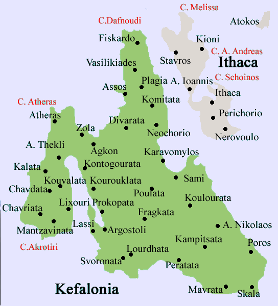
Dilinata (Greek: Διλινάτα) is a small settlement located 9 km northeast of Argostoli, NW of Sami and north of the Argostoli-Sami Road (GR-50) and E of Davgata. Faraklata is passed by the road linking near Razata and Dilinata and is the point to the uneven road to Makriotika and also to Davgata and the western part of the island. The village sits on a mountain and a valey areas and also has farmlands as well. Faraklata also features a small cave east of the area. More valleys are to the west and east and a mountains to the south. The mountaintop of Evmorfia elevating up to 1,043 m is almost due northeast and except for the summer months, the mountain does not block the sun during the morning hours. Much of the population are rural and the main economy is based on agriculture. The income is in the middle range. Much of the population from the mid-20th century left for larger towns and mainly cities. The 1953 Ionian Earthquake destroyed every building in Dilinata that took months to rebuilt, it also lost people in the village. The entire population that time as well as other parts of the island were homeless and part of the population left Dilinata. Nearest places
Historical population
See also Retrieved from "http://en.wikipedia.org"
 |
|
||||||||||||||||||||||||