|
|
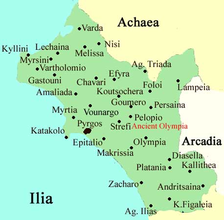
Kalyvia (Greek: Καλύβια) or Kalyvion Ilidos, is a village in the northern part of the municipality of Amaliada and the northwest part of the prefecture of Ilia. It is accessed by a road connecting Gastouni and the Peneus Dam. GR-9/E55 (68th km of the Patras - Pyrgos Hwy). It is located 11 km E of Gastouni, about 10 km from GR-9/E55, about 8 km W of the dam and about 10 km N of Amaliada. Nearest places
Geography Location:
Postal code: 273 00 Elevation: 15 m Dialing code: +11+30-26220 (030-26220)
Historical population Year Communal population 1981 424 Kalyvia is one of the slowest villages in population growth from 1981 to 1991 but declined from 1991 to 2001. Kalyvia has a school, a church, and a square (plateia). Pastured lands and mixed farming dominated the northern part while groves and forests cover the western, southern and the eastern part. The hills are situated east of the communal boundary. Some forests dominate the area up to the river. See also
Links
 |
|
|||||||||||||||