|
|
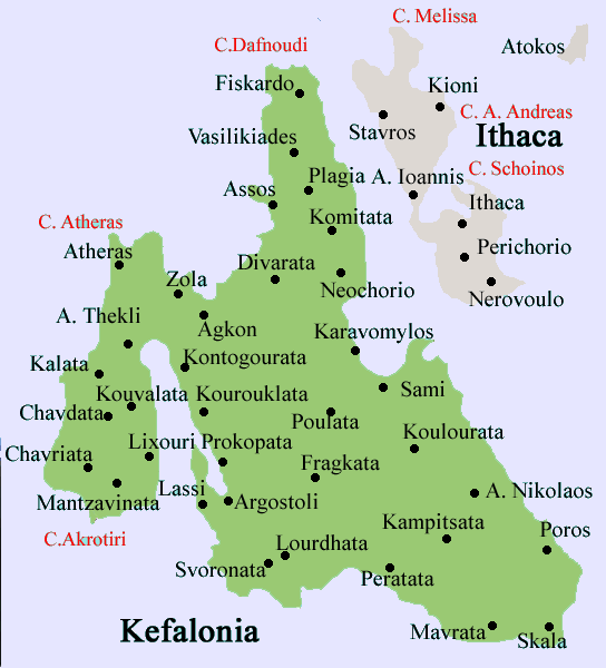
Fragkata (Greek: Φραγκάτα), also Frangata is a village located 8 km east of Argostoli, about 40 km W of Poros and south of the Argostoli-Sami Road (GR-50) in the community of Omala on the island of Kefalonia. Fragkata is linked with a road linking with the Travliata-Frangata Road and the Argostoli-Sami Road (GR-50). The village sits on a plateau with a small hills north of Frangata. The Gioupari mountain lies to the east and smaller mountains westward and are covered with pines, spruces, and other types of trees. The plateau dominates the north. Much of the population are rural and the main economy is based on agriculture with business relating to restaurants, education and bars. The income is in the middle range. Much of the population from the mid-20th century left for larger towns and mainly cities. The 1953 Ionian Earthquake destroyed every building in Fragkata that took months to rebuilt. The entire population that time as well as other parts of the island were homeless and part of the population left Valsamata. Nearest places Valsamata, south Other Fragkata has a school, a middle (lyceum) and secondary (gymnasium) schools, a church, a post office and a square (plateia).
|
|
||||||||||||||||||||||||||