|
|
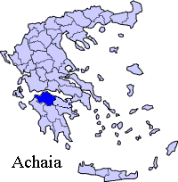
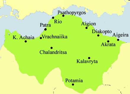
Psathopyrgos or Psathopirgos (Greek: fr. ψάθος psathos prob. meaning fishing net + πύργος pyrgos meaning tower) is a touristic village located in the municipality of Rio in the northern part of the prefecture of Achaia and is the northernmost community in the Peloponnese in location. Psathopyrgos is located southeast Cape Drepano is a trapezoidal cape facing the northwest and is the northernmost point in the Peloponnese and the prefecture of Achaia. The village is connected slightly north with two roads linking the old GR-8 linking Patras and Corinth and southwest to Arachovitika. The nearest interchange for the GR-8A superhighway is nearly 9 km WSW via the roundabout. The Gulf of Corinth lies directly to the east via the 800 m seaside main street and undirectly to the north and the Strait of Rio-Antirio west of the cape. It is located about 9 km NE of Rio, about 15 km NE of Patras about 9 km ENE of the Rio-Antirio Bridge and 214 km W of Athens via the new road and about about 210 km W from the old highway. Nearest places
Geography Location:
Postal code: 265 00 Elevation:
Dialing code: +11+30-2610 (030-2610)-93x xxx Historical population
Psathopyrgos has a school, a church, a small port and a square (plateia). Arachovitika is also the northernmost and the easternmost suburban Patras community. Psathopyrgos is very famous for its beaches located to the northwest stretching up from southeast of the cape up 800 m SE to the cliffs. The area also includes hotels including Hotel Rodini and Florida Blue Bay. The next main industry are agriculture and fishing. The area around Psathopyrgos has mainly groves with a few pasture lands and other types of crop surrounding the area to the west and southest. Half of the land is groves. The mountains lie to the south. Forests are situated to the south and the eastern part and are filled with pine trees while grasslands are in the slopey parts. There have never been suburban housing developments. Arachovitika is bounded by the superhighway GR-8A/E65 (Patras - Athens) which also accesses to GR-5/E55, GR-9/E55 and GR-48/E65]] through the westbound lanes to its southeast and east. The Panachaiko cannot be seen, the mountains of southeastern part of Acarnania including Nafpaktia with Nafpaktos and the southern part of Phokida is to the west and the Rio-Antirio bridge can rarely be seen. The small stream which flows about 2 km west of Psathopyrgos. The railway runs north of Psathopyrgos. The new superhighway runs south of the community. It was constructed in the mid 20th century along with an interchange with two curves. It was opened a few years later. Links See also:
 |
|
||||||||||||||||||||||