|
|
|
||
| Population: (2001) | 4134 | ||
| Elevation: -lowest: -centre: -highest: |
about 10 m about 214 m(centre) around 600 to 800 m |
||
| Postal code: | 322 00 320 09 |
||
| Area/distance code: | 11-30-22620, (030-22620)-7 | ||
| Municipal code: | 0819 | ||
| Car designation: | BI |
||
| 3-letter abbreviation: | TNG (Tanagra) | ||
| Name of inhabitants: | Tanagran or Tanagrian sing., -s pl. |
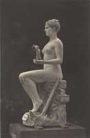
It was the site of two Battles of Tanagra, in 457 BC and 426 BC.
It can be accessed by GR-1 in the north and by a provincial road linking Thiva (Thebes) in the west. It is located SE of Thiva and Arma, SW of Schimatari and NW of Agios Thomas. The town is situated between the base and the highway. Tanagra is served by two interchanges, a partial southbound exit, a northbound entrance to the northwest and an almost-full to the east, serving access to highways 44 and 77 to the island of Euboea. Its service road lies to the south and is linked with the southeast bypass and to the military base. Farmlands surround the rest of Tanagra, and the Asopus River along with the Parnitha mountains to the south.
Today, Tanagra Air Force base is home to the 114 Combat Wing of the Hellenic Air Force, and is one of Greece's largest military bases. Its runway is about 2 km in length.
Historical population
| Year | Communal population |
|---|---|
| 2001 | 1102 |
Other
Tanagra has schools, a few lyceums, a gymnasium, a few churches, a post office and a few squares (plateies).

Tanagra Satellite image
Division of the municipality of Tanagra with population 4134
- Arma / Δ.δ. Άρματος -- το [1070]
- Asopia / Δ.δ. Ασωπίας -- η [1267]
- Kallithea / Δ.δ. Καλλιθέας -- η Καλλιθέα [695]
- Tanagra / Δ.δ. Τανάγρας [1102]
- Tanagra / η Τανάγρα [871]
- Panagia / η Παναγία [231]
- Tanagra / η Τανάγρα [871]
|
Municipalities and communities of the Boeotia (Voitia) Prefecture
Akraifnia | Aliartos | Arachova | Chaironeia | Davleia | Dervenochori | Distomo | Koroneia | Livadeia | Oinofyta | Orchomenos | Plataies | Schimatari | Tanagra | Thebes | Thespies | Thisvi | Vagia |

|
Ancient Greece |
Medieval Greece / Byzantine Empire |
Modern Greece |
|---|---|---|
|
Science, Technology , Medicine , Warfare |
Science, Technology, Arts |
Cities, Islands, Regions, Fauna/Flora , |
|
- Index
|


|
|