|
|
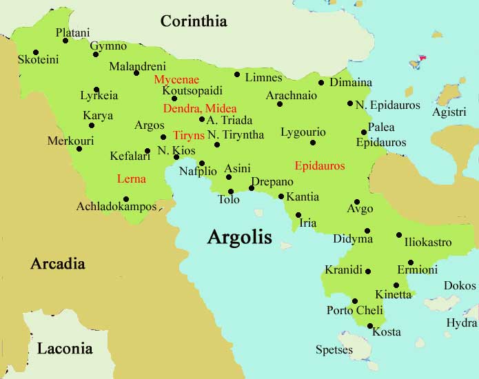
Mykines or Mikines (Greek Μυκήνες) is a village and a municipality located 1 km west of the ancient site of Mycenae and 2 km east of the highway linking Argos and Corinth. In medieval times it was known as Charvati.
The village has a school, a church and a square (plateia)
Division of Mykines Municipality
- Mykines / Δ.δ. Μυκηνών -- οι Μυκήνες [ 422 ]
- Limnes / Δ.δ. Λιμνών -- οι Λίμνες [ 920 ]
- Monastirakion / Δ.δ. Μοναστηρακίου -- το Μοναστηράκιον [ 368 ]
- Borsa / Δ.δ. Μπόρσα -- ο Μπόρσας [ 214 ]
- Neo Iraion / Δ.δ. Νέου Ηραίου (Χώνικα) -- το Νέον Ηραίον (τ.Χώνικας) [ 585 ]
- Prosymna / Δ.δ. Προσύμνης -- η Πρόσυμνα [ 919 ]
- Fichtion / Δ.δ. Φιχτίου -- το Φίχτιον [ 921 ]
Historical population
Year Communal population Change Municipal population
1981 440 - - -
1991 436 -4/-9.09% 4,412
Mykines
Μυκήνες
Periphery Peloponnese
Prefecture Argolis
Province
Population 4,349 (2001)
Metropolitan area population
Area km²
Metropolitan area km²
Population density /km²
Metropolitan pop. density /km²
Elevation 75 m
Coordinates 37°43′ N 22°45′ E
Postal code 212 00
Area code 27510
Licence plate code AP
|
Ancient Greece
|
Medieval Greece / Byzantine Empire
|
Modern Greece
|
|
Science, Technology , Medicine , Warfare
, Biographies , Life , Cities/Places/Maps , Arts , Literature , Philosophy ,Olympics, Mythology , History , Images
|
Science, Technology, Arts
, Warfare , Literature, Biographies
Icons, History
|
Cities, Islands, Regions, Fauna/Flora ,
Biographies , History , Warfare
Science/Technology, Literature, Music , Arts , Film/Actors , Sport , Fashion
|

|
|