|
|
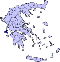
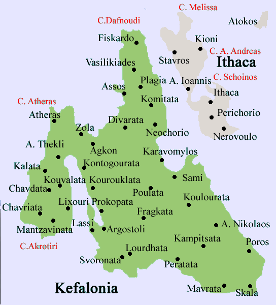
Agia Eirini (Greek, Άγια Ειρήνη, for Saint Irene) is a community located in the municipality of Elaios-Pronnoi in the southeastern part of the island of Kefalonia. Distances are 6 km north of Pastra and SW of Tzanata along with Poros, and S of Sami. It is located on a road connecting Argostoli with Poros and Sami. The nearby communities are Andriolata on the other side in the west, Tzanata to the east and Agios Georgios to the south.
Location:
- Latitude: 38.12/38°7'9' N
- Longitude: 20.775/20°45'22' E
Population: around 200
Postal code: 280 82
Elevation: 90 m
Dialing code: +30-26740
Historical population
| Year |
Communal population |
| 1981 |
284 |
| 1991 |
306 |
| 2001 |
363 |
The village has a small school, a church named Agia Eirini, and square (plateia). Most of the residential houses are ligned within the Argostoli-Poros Road. The area is covered with olive groves and pasture lands except for the south and around its land where two mountain ranges surround almost the entire village except for the north.
Municipal districts with settlements in brackets
Agia Eirini | Agios Georgios | Agios Nikolaos | Argini | Chionata (Kolaitis | Thiramonas) | Markopoulo (Kateleios | Kato Kateleios) | Mavrata | Pastra (Kremmydi) | Poros (Asprogerakas | Kampitsata | Riza | Tzanata) | Skala (Alimata | Fanies | Ratzakli) | Valerianos (Atsoupades | Plateies) | Xenopoulo (Andriolata | Kapandriti
|
Communities of Kefalonia
Retrieved from "http://en.wikipedia.org"
All text is available under the terms of the GNU Free Documentation License
|
Ancient Greece
|
Medieval Greece / Byzantine Empire
|
Modern Greece
|
|
Science, Technology , Medicine , Warfare
, Biographies , Life , Cities/Places/Maps , Arts , Literature , Philosophy ,Olympics, Mythology , History , Images
|
Science, Technology, Arts
, Warfare , Literature, Biographies
Icons, History
|
Cities, Islands, Regions, Fauna/Flora ,
Biographies , History , Warfare
Science/Technology, Literature, Music , Arts , Film/Actors , Sport , Fashion
|
|
|