|
|
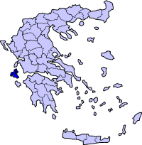
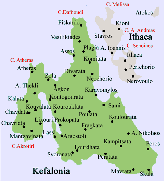
Markopoulo (Greek: Modern:, Μάρκοπουλο Ancient/Katharevousa: Μάρκοπουλον) is a village founded in the southeast part of Kefalonia. It is located about 25 km SE of Argostoli, north above Kateleios and 25 km SW of Poros following a curvy mountain road. It sits on the southern slope of the Aenos range and the ground is rocky with one exception of pastures and olive groves to the south. The village sits on a slope with a valley near the plateia (square) with a dangerous cliff. Buildings are aligned entirely with a major highway linking Poros and Argostoli. Its nearby communities are Kremmydi, Platiae, and Kateleios, its closest beach. The southwest has a small moutain ridge.
Geography
Location:
- Latitude: 38.075 (38°4'34') N
- Longitude: 20.698 (20°43'53') E
Postal code: 280 82
Elevation: 154 m
Dialing code: +30-27610 (030-26710)
Historical population
| Year |
Communal population |
| 1981 |
175 |
| 1991 |
81 |
| 2001 |
90 |
Links
See also
Municipal districts with settlements in brackets
Agia Eirini | Agios Georgios | Agios Nikolaos | Argini | Chionata (Kolaitis | Thiramonas) | Markopoulo (Kateleios | Kato Kateleios) | Mavrata | Pastra (Kremmydi) | Poros (Asprogerakas | Kampitsata | Riza | Tzanata) | Skala (Alimata | Fanies | Ratzakli) | Valerianos (Atsoupades | Plateies) | Xenopoulo (Andriolata | Kapandriti
|
Communities of Kefalonia
|
Ancient Greece
|
Medieval Greece / Byzantine Empire
|
Modern Greece
|
|
Science, Technology , Medicine , Warfare
, Biographies , Life , Cities/Places/Maps , Arts , Literature , Philosophy ,Olympics, Mythology , History , Images
|
Science, Technology, Arts
, Warfare , Literature, Biographies
Icons, History
|
Cities, Islands, Regions, Fauna/Flora ,
Biographies , History , Warfare
Science/Technology, Literature, Music , Arts , Film/Actors , Sport , Fashion
|
|
|