|
|
|
Population: (2001)
|
4.297
|
Elevation:
-lowest:
-centre:
-highest: |
about 5 to 6 m
15 m(centre)
about 100 to 150 m |
| Number of communities: |
8 |
| Postal code: |
271 00 |
| Municipal code: |
1711 |
| Car designation: |
HA |
| 3-letter abbreviation: |
IAR Iardanos |
Geography
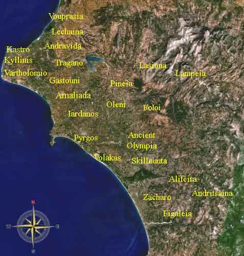
Vounargo is surrounded by olive and other types of groves along with pastures and mixed farming. The mountains with forests and several mountaintops and valleys lies to the north and to the northwest. Much of the mountains are forested. A mining area which is situated north of Vounargo is presently abandoned.
Historical population
| Year |
Population |
Municipal population |
| 1981 |
922 |
- |
| 1991 |
847 |
4103 |
| 2001 |
750 |
4279 |
Other
Vounargo has a school, a lyceum, a high school, a church, banks, and a post office, a water tower, and a square (plateia).
- , street map not yet available