- http://arcadia.ecid.upatras.gr/arkadia/places/labeia.htm (in Greek)
- http://users.otenet.gr/~ancoil/divria.htm (in Greek)
- http://users.otenet.gr/~ancoil/trick.htm (in Greek)
|
|
|
||
| Population: (2001) | 1.374 | ||
| Elevation: -lowest: -centre: -highest: |
Ladon valley 803 m 1,797 m Divri/Mount Lampeia |
||
| Postal code: | 270 63 | ||
| Area/distance code: | 11-30-26240-8 (030-26240-8) |
||
| Municipal code: | 1713 | ||
| Car designation: | HA |
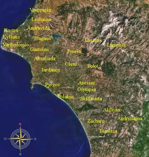
Lampeia (Greek: Λαμπεία, Romanization before the 1990s, Lambia), rarely Lampia, is a Greek town and a muinicipality on the southern part of the Divri (Δίβρη) range and is also known as that name. Its population was 661 in the year 2001. Lampeia is in a valley setting and GR-33 passes through narrowly. Distance from Patras is 82 km S, nearly 50 km N of Olympia and 70 km NW of Tripoli. The town sprawls over the southwestern shoulder and does not cover. GR-33 runs within the valley with the length of about 5 km. The land outside Lampeia is mostly rocky.
In ancient times it was part of Arcadia. It is presently in the northeastern part of the prefecture of Ilia.
Nearest places (commune)
- Amygdali
- Astra
- Tripotamia (east)
Division of the Lampeia municipality with a population 1.374
- Lampeia / Δ.δ. Λαμπείας [ 764 ]
- Lampeia / η [ 661 ]
- Amygdali / η Αμυγδαλή [ 103 ]
- Lampeia / η [ 661 ]
- Astras / Δ.δ. Αστρά [ 407 ]
- Astras / ο Αστράς [ 196 ]
- Kalyvia Astra / τα Καλύβια Αστρά [ 211 ]
- Astras / ο Αστράς [ 196 ]
- Oreini / Δ.δ. Ορεινής [ 203 ]
- Oreini / η [ 189 ]
- Paliofytia / η Παλιοφυτιά [ 14 ]
- Oreini / η [ 189 ]
Historical population: