|
|
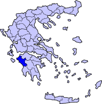
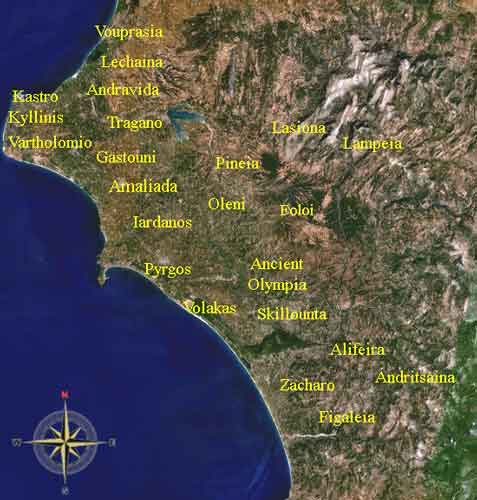
Sosti (Greek, Modern: Σοστί, Ancient/Katharevousa: -on), older spellings, Sostio, Sostion, formerly Vlachaiika is a community located between Afgeio and Amaliada in the municipality of Amaliada and the prefecture of Ilia. Distance from Amaliada is about 4 km N, Gastouni is about 10 km and GR-9/E55 is 9 km ESE, and about 11 km W of the Peneus Barrier. Sosti as a community was formed after a law of 1919. It was formed from the community Bouhioti (Avgreion) of the formed municipality of Ilida. After a law of 1927 Labdeika was included former part of the municipality of Amaliada. The name Sostis according to a version means "Saviour", as it helped according to a legend some troops of Kolokotronis to survive in the village, although not much is known about the village itself in the Ottoman period. A church Koimisis tis Theotokou was build 1871 in the region, and an inscription was found in the small nearby church Agios Georgios from 1471. In a place called Zeza in 1821 there was a battle between Greek troops of Sisinis and Ottoman forces. Since 1902 the village had an elementary school Nearest places
Location:
Postal code: 272 00 Elevation: about 10 m highest: 50 m Dialing code: +30-26220
The village has a small school, a church and a (plateia). The area is used for farming but the area is also mixed with olive groves and some forests. Hilly settings are mainly founded in its east especially near the Links
See also
 |
|
|||||||||||||||||||||||


|
|