|
|
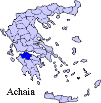
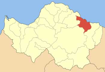
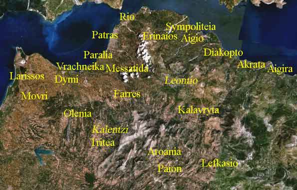
Mamousia or Mamoussia (Greek: ), also with an i accented is a Greek village located about west of Corinth and Athens, north-northwest of Kalavryta and east of Aigio and Patras. The village with a population 177 in 2001 is part of a synonymous district with a population 295 of the municipality of Diakopto. The GR-9 (Patras - Pyrgos - Kyparissia) is around the area.
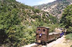
Population Year Population Municipal district population 1981 382 - Geography Its geography are mainly mountainous with farmlands in its valleys. The Vouraikos is next to Mamousia. History The ancient Boura was destroyed along with the cities of the Achaean League by a great earthquake which damaged along with ancient Eliki. From the name of the city, it received the name of the neighbouring river, Vouraikos (then Buraicus). The area was later ruled by the Romans, the Eastern Romans and the Byzantines. Mamousia was later founded. It was later ruled by the Franks, the Ottoman Turks with some interruption by the Venetians in the mid to late-15th century and the mid to late-16th century. Mamousia was finally Greek after the Greek War of Independence of 1821, right after the signing of the declaration of independence. After World War II and the Greek Civil War, much of the population left for larger towns and cities especially the nearby Patras. The population declined since 1981. Houses were stone-built until the 1950s and did not surpass modern-style homes until the 1980s. It was linked with pavement in the 1980s. Most of the homes are abandoned today. Mamousia has an ancient area that above the archaeological city had an ancient theatre in which most of the have yet to be excavated, several artifacts are on displayed at the Aigio Archeological Museum. On July 24 and July 25, 2007, Mamousia was struck by an enormous fire that damaged almost 70 to 80% of the entire area along with its forests. Firefighters, along with helicopters and planes battled the fire. It also damaged olive groves and grapevines. It also destroyed its natural beauty. Information The village is built on the slopes of Chelmos with a beautiful scenery of its pine forest. Mamousia has approximately 5 to 6 km of paved road and 10 km of gravel roads. Aravonitsa also has approximately 6 to 8 km of hydro lines as well as phone lines. Economy Its main production are fruits including watermelon, melon, figs and vegetables including corn, tomatoes, potatoes, onions, cucumbers and others as well as dairy, livestock, olives and others. The majority of the population are based in other businesses as well as agriculture with some other industries. Other Mamousia has a school, a church, and a square (plateia). Its nearest lyceum (middle school), a nearest school gymnasium (secondary school) are in Diakopto, its nearest hospital is the Agios Andreas Hospital in eastcentral Patras.
Informations: www.diakofto.com.
Retrieved from "http://en.wikipedia.org/"
 |
|
|||||||||||||||
|
|