|
|
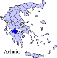
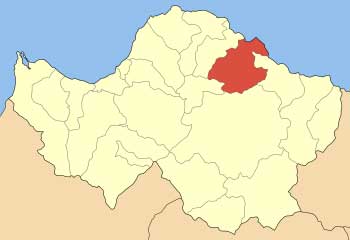
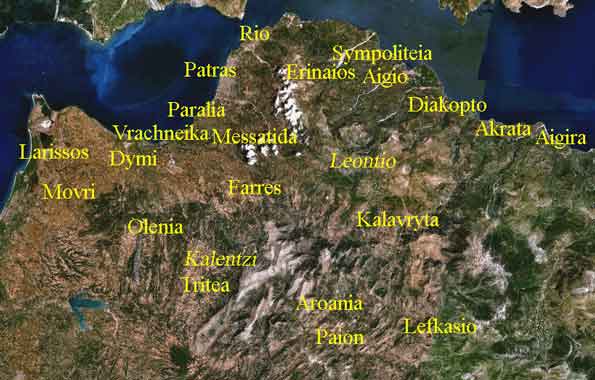
Melissia (Greek: Μελίσσια meaning honeycombs) is a Greek village in Achaea, Greece, part of the municipality of Aigio. It is located 10 to 15 km south of Aigio, west of Corinth and about 185 km west Athens, north-northwest of Kalavryta and about 45 east of Patras. The GR-9 (Patras - Pyrgos - Kyparissia is to the north and the GR-31 (Aigio - Pteri - Kalavryta) runs near the village. Melissia had a 2001 population of 358 for the village and 427 or the municipal district.
* Lakka
* Selinounta, northeast
Geography Its geography are mare up of farmlands that dominate the valley areas and are mainly consists of groves, the mountains that are mainly made up of forests and grasslands especially bushes are around the area. The village is situated by the Selinountas River. History The village was ruled by the Ottoman Turks with some interruption by the Venetians in the mid to late-15th century and the mid to late-16th century. Melissia was finally Greek after the Greek War of Independence of 1821, right after the signing of the declaration of independence. After World War II and the Greek Civil War, much of the population left for larger towns and cities especially the nearby Patras. The population declined since 1981. Houses were stone-built until the 1950s and did not surpass modern-style homes until the 1980s. It was linked with pavement in the 1980s. Most of the homes are abandoned today. Melissia was battered by a forest fire that began on Wednesday July 25 and ended on July 29 and brought catastrophic fire to the area, flames were bursting as high as 30 m and smoke as high as 600 to 700 m. About 20 to 30% of the village wer burnt with some of their properties burnt. One fire was on a mountain slope that created a smoke enough to cover the area and darken the area tan-brown. Tens of fire trucks, helicopters and planes along with firefighters battled the fire in order to end. Several farms and crops were ruined. Some roads were shut down. The fire started in the afternoon hours and expanded to almost to burn about 80 to 90% of the area of Melissia. Residents were panicked on this wildfire. Hundreds to thousands of cattle were lost and about ten thousands trees were burnt down that created an economic and agricultural disaster that may take a couple of years to rebuilt. The flames were stopped by firefighters and headed for other villages in central and southern Aigialeia and finally ended. Information Melissia has approximately 6 to 8 km of paved road and 15 km of gravel roads. Kounina also has approximately 6 to 8 km of hydro lines as well as phone lines. Economy Its main production are olives alond with fruits including watermelon, melon, figs and vegetables including corn, tomatoes, potatoes, onions, cucumbers and others as well as dairy, livestock and others in small numbers, much of the farlmands are mainly groves and vines. The majority of the population are based in agriculture as well as some other businesses.
 |
|
||||||||||||