


- Loussios Gorge
- http://arcadia.ceid.upatras.gr/arkadia/engversion/places/karitena.htm (in Greek)
- http://hellas.teipir.gr/greek/Arkadias/Karitaina.htm (in Greek)
- http://www.arcadia.gr/greek_ver/c3/sc5/main.htm
- arkadia/archsites/xwroi/gortis.htm Ancient Gortys and the Loussios Gorge
- Ancient Gortys (in Greek)
- http://arcadia.ceid.upatras.gr/arkadia/ arcadia-hist/topics/gortis.html (in Greek)
|
|
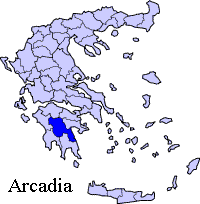
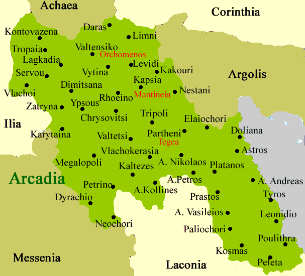
Karytaina (Greek: Καρύταινα or , also written as Karitena), is a town located in the western part of the prefecture of Arcadia in the central Peloponnese. It is the seat of the municipality of Gortyna (Γορτυνία). Skorta was the Frankish domination name. The shortest length is about 200 ot 300 m. It is located about just 1 km NW from GR-76 (Krestena - Andritsaina - Megalopoli), 1 km NW of the Karytaina - Stemnitsa - Dimitsana road, 25 km SW of Dimitsana, about 50 km (old: 54 km) W of Tripoli, 26 km NW of Megalopoli, about 28 km (old: 25 km) from GR-7/E65, about 75 km (old: 80 km) N of Kalamata, about 70 km SE of Krestena and about 72 to 75 km SE of GR-9/E55 and 28 km E of Andritsaina. The location is on a triangular-trapezoidal rocky hill with bushes and some forests which include a fortress on the top. The name of the municipality dates back to the ancient times as an ancient region. The ancient settlement of Gortys (modern: Γόρτυνος, Ancient.Katharevousa: Γόρτυς), modern Gortynos which Gortynia comes from is to the north. In the Medieval times, Karytaina used to be known as the Toledo of Greece. It is bordered with the prefecture of Ilia in the west along with its boundary over a steep cliff in the west where the highway passes. Division of the municipalityKa
Historical population
The population lost 661 inhabitants or 71.85% of the total population between 1920 and 1991. The last time the population lost inhabitants. The population recovered in 1990 being one of the few places where the population didn't boom since the early to mid-20th century. The decline slowed every ten years until 1991. Karytaina has a school, a lyceum, a church, a post office, a gas station, and a square (plateia). Karytaina is surrounded by mountains and a larger one to the north. The houses are about 50 m lower than the fortress and line straightly to the other side of the mountain. The groves are to the east and south and areas under 482 m. Much of the area are mountains and has a rocky landscape and bushes. The plain of Megalopolis is to the southeast. The forests are to the south and in the valleys where the Alpheus River flows to the south. It includes an old bridge which was used until the 1960s. The population was entirely consists of agriculture and the main production was cereals and silk.
Fortress of Karytaina
Fortress of Karytaina, Image c 1910
In the ancient times, an ancient highway linking Patras and Kalamata via Sparta passed near the Alpheus river. Another river is the Loussios (ancient: Lussius) which flows west of Karytaina which begins east of Lagkadia. The length is about 40 km. The origin of the name comes from the ancient form of loutra, loussis meaning bath in Ancient Greek. In the Greek War of Independence in 1821, Nikitas Stamatetopoulos, Ilias Mavromichalis, the Plaplouta brothers, Kanellos Deligiannis and his army headed north fo Karytaina after the events in Kalamata. Sites of Interest Castle of Karytaina - built on a steep rocky outcrop NW of Karytaina. It was first built in 1245 by Hugues De Bruyere, Links
Retrieved from "http://en.wikipedia.org"
 |
|
|||||||||||||||||||||||||||||||||||||||||||||||||||||||||||||||||||||||