|
|
|
||||||||||||||||||||||||||
| Area: |
143.911 km² |
||||||||||||||||||||||||||
| Population: (2001) |
2104 | ||||||||||||||||||||||||||
| Elevation: -lowest: -centre: -highest: |
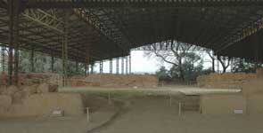
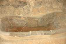
Bronze Age Pylos was excavated by Carl Blegen in 1952. It is located at modern Ano Englianos, about 9km north-east of the bay. Blegen called the remains of a large Mycenean palace found there the "Palace of Nestor", after the character Nestor, who ruled over "Sandy Pylos" in the Homeric poems. Linear B tablets found by Blegen clearly demonstrate that the site itself was called Pylos (Mycenaean Greek Pulos, Linear B Pu-ro) by its Mycenean inhabitants. This site was abandoned sometime after the 8th century BC and was apparently unknown in the classical period.
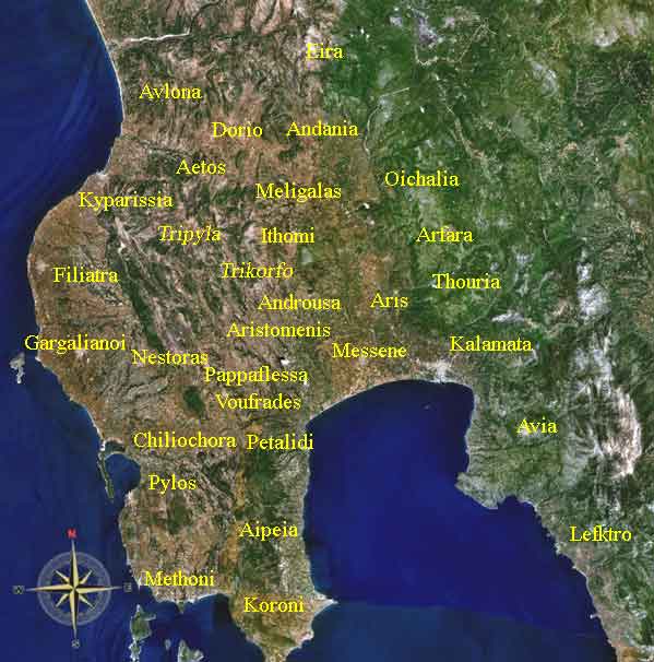
Pylos from Space, NASA Navarino and the island of Sphagia. The site of classical Pylos was probably on the rocky promontory now known as Koryphasion at the northern edge of the bay of Pylos. This site is described by the Greek historian Thucydides in his History of the Peloponnesian War. In 425 BC the Athenian politician Cleon sent an expedition to Pylos, to seize and occupy the bay. The Athenians captured a number of Spartan troops on the adjacent island of Sphacteria (see Battle of Sphacteria). Spartan anxiety over the return of the prisoners, who were taken to Athens as hostages, contributed to their acceptance of the Peace of Nicias in 421 BC. Pylos has a school, a lyceum, a gymnasium, a church, banks, a post office, a port which was expanded in the 1990s and a square (plateia) called the "Three Admirals' Square" (see Battle of Navarino). Division of the municipality of Pylos
Chomatada Historical population
See also:
 |
|
|||||||||||||||||||||||||


|
|