|
|
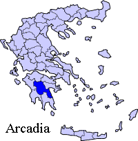
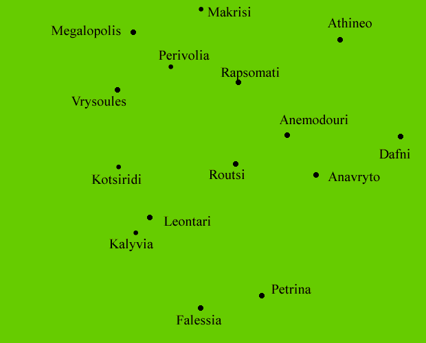
Routsi (Greek, Modern: Ρούτσι, Ancient/Katharevousa: -on), older form Routsion is a village and is in the eastern part of the municipality of Falaisia. Distance from Megalopolis is 11 km SE. The nearby communities and villages are Perivolia to the NW, Rapsommati to the N, Anemodouri to the NE and E, and Anavryto to the SE. It is located on a road between Megalopolis and Anavryto, about 45 km SW of Tripoli, 6 km W of Anavryto, about 13 km SE of Megalopoli and about 65 km NNE of Kalamata and E of Kyparissia. Population:
Location:
Postal code: 220 21 Elevation: 450 m Area code: +11+30-27910 (030-27910) The village has a church, a small plateia, and a train station located down the valley connecting the rail near the main road (Megalopolis-Anavryto). The station has two windows and a door facing the east. The size of the station is small and is surrounded with two circled trees while several other trees lie to the east. The village is situated on a hill and is almost completely surrounded by a forest. The main road in the center is divied into two narrow parts. Light green grasslands are to the south and the southeast. Mountains are to the south and east. Links University of Patras on Routsi
Retrieved from "http://en.wikipedia.org"
 |
|
|||||||||||||


|
|