|
|
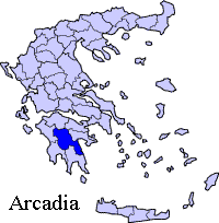
Vrysoules (Greek, Modern: Βρυσούλες, Ancient/Katharevousa: -ai, from the Modern spelling βρύση vrysi + -ούλα -oula + plural -ες -es, little springs), older form, Vrisoulai, Vrisoules is a village that is almost completely surrounded by forests 4 km SE of Megalopoli and is part of the municipality of Megalopoli in the southwestern part of the prefecture of Arcadia. It is part of the commune of Perivolia. It is linked by GR-7/E55, about 1 km W for the old one and 3 km south for the new one. It is located S of Dimitsana and about 28 km SE of Karytaina, 35.6 km (old: 37 km) WSW of Tripoli, WNW of Leontari, NE of NNE of Kalamata and ENE of Kyparissia. Nearest places
Geography Location:
Postal code: 222 00 Elevation: 420 m Dialing code: +11+30-27910 (030-27910) Historical population
It is one of the villages that only lost slightly more than 60% of its population from 1921 to 2001. The village has a small school, a church and a central square (plateia) next to the church which is not much more than the village well. Its residential houses are mainly within the road. The village used to have a school. It is now located north of the superhighway. West of the rail is a mine. The village is bounded by a separate railway from the west, and is not bounded by the new highway (superhighway) to the southeast but further south with Falaisia at the Alpheus river which is south of Vrysoules, east is Perivolia. The village until 1927 was known as Aliaga (Αλήαγα), so named during the Ottoman era for Ali Aga, an Ottoman dignitary who visited the village. Much of the area are forested with trees which its height is between 10 to 15 m. Farmlands are around the village and within the old road. In 2000, the forests were beginning to be cut along the new highway and the junction with Vrysoules at Megalopoli to Anavryto Road is now south of the superhighway and an underpass is slightly 1 km west of the junction.
 |
|
||||||||||||||||||||||||||||


|
|