, street map not available Coordinates:
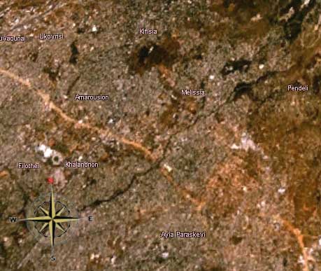
Melissia Attica Satellite image
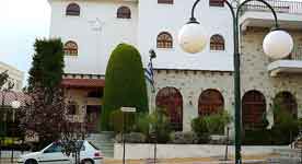
Entrance, Municipality of Melissia
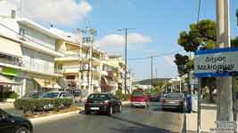
Melissia Trading Center
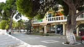
Melissia , Monument dedicated to Minor Asia
Cultural Center Melissia
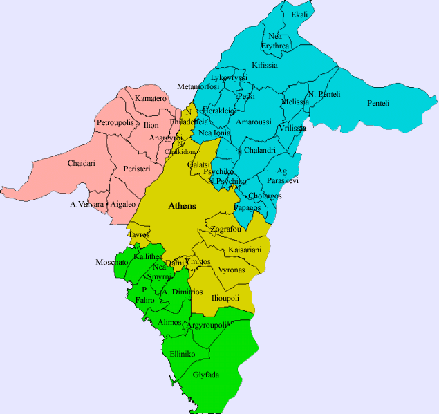
Municipalities of Athens
Agia Varvara | Agia Paraskevi | Agioi Anargyroi | Agios Dimitrios | Athens | Aigaleo | Alimos | Amarousi | Argyroupoli | Chaidari | Chalandri | Cholargos | Dafni | Ellinikon | Filothei | Galatsi | Glyfada | Heraklio | Ilio | Ilioupoli | Kaisariani | Kallithea | Kamatero | Kifissia | Lykovryssi | Melissia | Metamorfosi | Nea Chalkidona | Nea Erythraia | Nea Ionia | Nea Filadelfeia | Nea Smyrni | Neo Psychiko | Palaio Faliro | Papagou | Pefki | Peristeri | Petroupoli | Psychiko | Tavros | Vrilissia | Vyrona | Ymittos | Zografou
(Non-municipal) Communities of Athens prefectural department
Ekali | Nea Penteli | Penteli
Municipalities of East Attica
Acharnai | Agios Stefanos | Artemida | Avlona | Gerakas | Glyka Nera | Kalyvia Thorikou | Keratea | Kropia | Lavreotiki | Marathon | Markopoulo Mesogeias | Nea Makri | Paiania | Pallini | Rafina | Spata | Vari | Vouliagmeni | Voula
(Non-municipal)Communities of East Attica
Afidnes | Agios Konstantinos | Anavyssos | Anoixi | Anthousa | Dionysos | Drosia | Grammatiko | Kalamos | Kapandriti | Kouvaras | Kryoneri | Malakasa | Markopoulo Oropou | Nea Palatia | Oropos | Palaia Fokaia | Pikermi | Polydendri | Rodopoli | Saronida | Skala Oropou | Stamata | Sykamino | Thrakomakedones | Varnava
Municipalities of the Piraeus prefectural department
Aegina | Agios Ioannis Rentis | Ampelakia Salaminas | Hydra | Korydallos | Kythira | Drapetsona | Methana | Nikaia | Perama | Piraeus | Poros | Salamina | Spetses | Troizina
(Non-municipal) Communities of the Piraeus prefectural department
Angistri | Antikythira
Provinces of the Piraeus prefectural department
Aigina | Kythira
Municipalities of West Attica
Ano Liosia | Aspropyrgos | Eleusis | Erythres | Fyli | Mandra | Megara | Nea Peramos | Vilia | Zefyri
(Non-Municipal) Communities of West Attica
Magoula | Oinoi
Retrieved from "http://en.wikipedia.org" All text is available under the terms of the GNU Free Documentation License
A - B - C - D - E - F - G - H - I - J - K - L - M
N - O - P - Q - R - S - T - U - V - W - X - Y - Z
Ancient Greece
Medieval Greece / Byzantine Empire
Modern Greece
Science, Technology , Medicine , Warfare , Biographies , Life , Cities/Places/Maps , Arts , Literature , Philosophy ,Olympics, Mythology , History , Images
Science, Technology, Arts , Warfare , Literature, Biographies Icons, History
Cities, Islands, Regions, Fauna/Flora , Biographies , History , Warfare Science/Technology, Literature, Music , Arts , Film/Actors , Sport , Fashion
Cyprus
Greek-Library -