


- Flag of Papagou
- Papagou Athletics (in Greek)
- http://www.geo.gr/papa (in Greek)
|
|
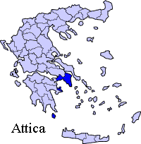
Papagou, uncommonly Papagos or Pappagos (Greek: ) is a suburb in the northeastern part of Athens, Greece. The city is named after the general Alexandros Papagos which he served in the Second World War. It is located W of Attiki Odos (number 65) which is also known as the Hymettus Ring which opened in 2004 with interchanges to the northeast and the southeast at Katechaki. It is located W of Rafina, NW of Eleftherios Venizelos International Airport, NE of Athens and Vouliagmenis Avenue and S of Kifissia and its northern suburbs. Papagou is accessed with the main roads of Katechaki Street with another main road linking to Olaf Palme Street in the south in Zografou and Mesogeios Avenue in Neo Psychiko to the west. Papagou started as a village or a settlement and later bacame a municipality. The local flag color is white with a blue cross that is a little extended with a red line. The golden-bronze bird-like statue-like thing is in the middle and the seal is in the top left. The area was made up of farmlands to the west and the rocky areas of the Hymettus. Urban development replaced much of the farmlands in the 1950s and up to around the 1970s or the 1980s. Today, from the western and to the east-cetnral part of the municipality are urbanized while the businesses are within its main roads of Katechaki Avenue in Zografou and Mesogeios Avenue (Gr-54 eastbound) to the east. Much of the trees are aligned with the streets and in squares. In 1998, the Hymettus Ring which is part of the Attiki Odos private superhighway system began construction with an interchange to the northeast along with a road with Agia Paraskevi. The hospital is located to the south in Zografou. Much of the residential streets has cul-de-sac streets and are mainly named after local famous people. The local non cul-de-sac roads and some streets are also founded. Forests and parks are aligned to three parts of Papagou. They are in the southern , the central and in the northern parts. A landfill of Athens is situated further east which takes the central and the southern part of Athens area's rubbish into this landfill. The area is about 200,000 to 250,000 square metres. The landfill has been in use since the mid to late 20th century. Papagou has schools, lyceums, gymnasia, banks, a post office and squares (plateies).
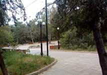
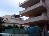
Great Papagou park, Constructions in Papagou, Cultural Hall of Papagou area,
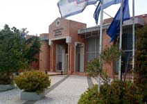
The Municipality Hall of Papagos, Architecture of Papagou, Sites of interest Stadium of Papagou's basketball team, AS Papagou Stadium of Papagou's football/soccer team, Olympias Papagou, Website Historical population
Links
Retrieved from "http://en.wikipedia.org/"
 |
|
|||||||||||||||||||||||||||||||||||||||||||||||||||||||||
