|
|
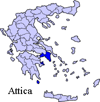
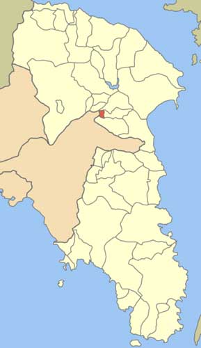
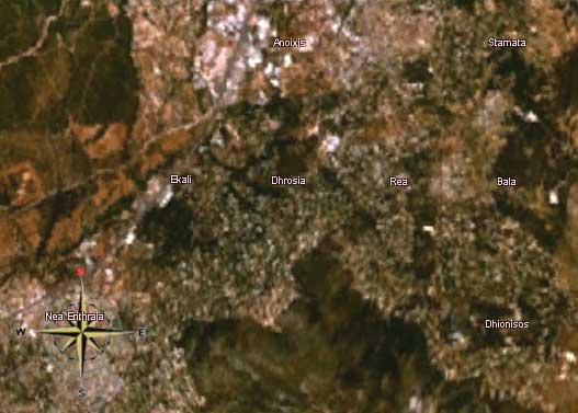
Drosia or Drossia (Greek: Δροσιά meaning cool, dew) is a rather exclusive suburb in Attica, Greece -- just about 22 km north of Athens. Drosia is a community of East Attica. Drosia is purely residential, which means there are no shops or night clubs. Drosia has strict building regulations to ensure the conservation of its character as a pleasant, green suburb. Drosia sits in the between the Athenian plain and the Penteli mountains. The plain is to the west, the forests of the mountains that are connected with the mountain north of Penteli is to the east. Drosia is bounded with the Megali Diktyo as well as the agglomeration to the south. Drosia is accessed with an interchange with GR-1/E75 (Athens - Lamia - Thessaloniki) at the 21st km near Varympompi 3 km west. The Cephissus River lies to the west. The main street is Theseos (Theseus) Avenue which is also GR-83, Grigoris Lamprakis Street and the road to Dionysos and Rea. Drosia is located SE of Thiva, S of Euboea and Oropos, W of Marathon, NE of Kifissia and NE of the Attiki Odos (number 6). History Drosia was first known and founded only during the Greco-Turkish War of 1919-1922, formerly mainly composed of farmlands. Its first inhabitants were from Pont and Asia Minor , and many of them could not head to Athens and Piraeus. The area was first named Rodopoli (Ροδόπολις, then as Rodopolis) in 1926 and was part of the community of Stamata, and the area of the settlement bordered with the authentic Bogiati (Μπογιάτι) ,which is now Anixi, and Neo Bogiati (Νέο Μπογιάτι), which is now Agios Stefanos. One neighbouring settlement of Stamata was the ball which adopted the name of the ancient city Rodopolis, the modern Drosia; a couple of years later, it adopted the name Rossochori or Roso(c)hori (Ρωσσοχώρι). The name was in use until 1952, when it the city was recreated according to a triangular plan, and was renamed as the present Drosia (Attica). Until the 1960s and the 1970s, farmlands covered the western part of Drosia. Most of the population is now urban; until the 1960s and the 1970s it was primarily rural. Luxury villas and apartment complexes now characterize most of the urban development in Drosia, so that forested areas are dwindling. Housing construction in the 1980s and the 1990s reached up to the foot of the Penteli mountain, and continues to this day. On September 7, 1999, the September 1999 earthquake shook Drosia causing no damages to property. Another natural disaster was a forest fire that came from Penteli ; a similar fire did not cause significant damage in 1995 , while in August 16, 2007 fire from the same direction during evening hours affected only houses adjacent to forests, as some trees are within the residential areas. It also affected weeds and dry grasses which needed to be cleaned or replaced with lawn grass. The fire lasted into the morning hours, and brought a few firefighters along with helicopters, as far as from Penteli. Other Drosia has few schools, lyceums, a few gymnasia, banks, churches, a post office and a few squares (plateies). Historical population
Drosia Google Earth
Drosia, Attica Satellite image
 |
|
||||||||||||||||||||||||||||||||||||||||||||||