Tavros (Attica)

Tavros (Greek: Ταύρος), is a suburb in the southwestern part of Athens, Greece. Athens is not far to the east and is 4 km from the town centre and 3 km from the boundary. It is also located 1 km from the Konstantinopouleos Street, 6 km E of downtown Piraeus, about 4 km E of Kifissos Avenue/GR-1/E75 northbound and about 1 km N of Syngrou Avenue.

It was called earlied Nea Sfageia, but was renamed to Tavros (gr. "Bull") in 1972.


The area was made up of farmlands and some forests dominated the northern part of the area. The forests filled with leafy trees including tall ones are aligned with the SPAP railway linkine Piraeus and Patras and Thessaloniki and within the main street, Piraios Street (GR-86), an old road linking downtown Athens and Piraeus. The area was of mixed farming which included pastures, vegetables and groves. Forests were to the east. In the 1900s and the 1920s, urban development replaced much of the farmlands. Today, much of the municipality are residential. The Industrial area is to the north.

Statistics
Prefecture: Attica
Metropolitan Area: Athens
Location: 37°57'57'' N 23°41'24'' E
Population: (2001)
14963
Elevation:
 -lowest:
 -centre:

about 10 m
15 m(centre)
around 50 m
Postal code: 177
Area/distance code: 11-30-210 (030-210)
-340 through 349
Municipal code: 0141
Car designation: Y (prev.)
Z pres.
3-letter abbreviation: TVR
Address of administration: Piraios and Eptalofou St.
Tavros 177 78
Mayor Dimitrios Soutos
(Δημήτριος Σούτος)

since 1998

The area is mainly made up of urban areas with a few business areas mainly within the Syngrou Avenue. The main streets are Piraios Street to the north, Konstantinopouleos Street with an interchange in the east and Syngrou Avenue south of the municipality.

Tavros has schools, lyceums, gymnasia, banks, post offices and squares (plateies).

Sites of Interests

Spyros Yalabidis Stadium, Tavros Municipal Stadium - seats up to 4,000, website: http://www.stadia.gr/tavros/http://www.hellenicaworld.com/Greece/Geo/en/Tavros.html

Historical population

Year Municipal population
1981 16514
1991 15456
2001 14963

Links

North: Agia Anni and Athens
West: Moschato Tavros East: Athens
South: Kallithea and Neo Faliro

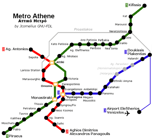
Metro Station Tavros (Source)

Athens Metro

Municipalities of Athens

Agia Varvara | Agia Paraskevi | Agioi Anargyroi | Agios Dimitrios | Athens | Aigaleo | Alimos | Amarousi | Argyroupoli | Chaidari | Chalandri | Cholargos | Dafni | Ellinikon | Filothei | Galatsi | Glyfada | Heraklio | Ilio | Ilioupoli | Kaisariani | Kallithea | Kamatero | Kifissia | Lykovryssi | Melissia | Metamorfosi | Nea Chalkidona | Nea Erythraia | Nea Ionia | Nea Filadelfeia | Nea Smyrni | Neo Psychiko | Palaio Faliro | Papagou | Pefki | Peristeri | Petroupoli | Psychiko | Tavros | Vrilissia | Vyrona | Ymittos | Zografou

(Non-municipal) Communities of Athens prefectural department

Ekali | Nea Penteli | Penteli

Municipalities of East Attica

Acharnai | Agios Stefanos | Artemida | Avlona | Gerakas | Glyka Nera | Kalyvia Thorikou | Keratea | Kropia | Lavreotiki | Marathon | Markopoulo Mesogeias | Nea Makri | Paiania | Pallini | Rafina | Spata | Vari | Vouliagmeni | Voula

(Non-municipal)Communities of East Attica

Afidnes | Agios Konstantinos | Anavyssos | Anoixi | Anthousa | Dionysos | Drosia | Grammatiko | Kalamos | Kapandriti | Kouvaras | Kryoneri | Malakasa | Markopoulo Oropou | Nea Palatia | Oropos | Palaia Fokaia | Pikermi | Polydendri | Rodopoli | Saronida | Skala Oropou | Stamata | Sykamino | Thrakomakedones | Varnava

Municipalities of the Piraeus prefectural department

Aegina | Agios Ioannis Rentis | Ampelakia Salaminas | Hydra | Korydallos | Kythira | Drapetsona | Methana | Nikaia | Perama | Piraeus | Poros | Salamina | Spetses | Troizina

(Non-municipal) Communities of the Piraeus prefectural department

Angistri | Antikythira

Provinces of the Piraeus prefectural department

Aigina | Kythira

Municipalities of West Attica

Ano Liosia | Aspropyrgos | Eleusis | Erythres | Fyli | Mandra | Megara | Nea Peramos | Vilia | Zefyri

(Non-Municipal) Communities of West Attica

Magoula | Oinoi

Retrieved from "http://en.wikipedia.org"
All text is available under the terms of the GNU Free Documentation License

A - B - C - D - E - F - G - H - I - J - K - L - M

N - O - P - Q - R - S - T - U - V - W - X - Y - Z

Γεωγραφία της Ελλάδας

Ancient Greece

Medieval Greece / Byzantine Empire

Modern Greece

Science, Technology , Medicine , Warfare
, Biographies , Life , Cities/Places/Maps , Arts , Literature , Philosophy ,Olympics, Mythology , History , Images

Science, Technology, Arts
, Warfare , Literature, Biographies
Icons, History

Cities, Islands, Regions, Fauna/Flora ,
Biographies , History , Warfare
Science/Technology, Literature, Music , Arts , Film/Actors , Sport , Fashion

Cyprus - World

>

Greek-Library - Scientific Library